Friday, October 9, 2009

The Colorado Trail: Aftermath and Continuation

Robyn and I finished our hike on July 23. We were very happy to finish the trail, but sad to see that part of our summer come to an end. Being out on the trail for 25 days together was a great experience that we are excited to repeat at some point in (near) future. It was great to meet Keith. We will surely have more backpacking experiences with him. He is already dropping us hints about the PCT!

We moved to Boulder two weeks before starting our hike. When we finished, we were able to properly take the time necessary to explore Boulder. Of course, that meant finding as many trails as possible. I got back into running straight away and we both spent a good deal of time hiking. Oh yeah, the town of Boulder itself is also quite cool.

Robyn coming down from Bear Peak

We drove back to Durango on August 1 to pick up our dog, Cassie. She had stayed with my parents for the summer while we moved and were on the Colorado Trail. It took her several days to get used to her new home, but she is enjoying her walks in the forest on the Shanahan Trails and her frequent trips in the car. She has also been going to rowing practice with Robyn and riding in the motorboat with Robyn while she coaches. Cassie loves the water!

Cassie in top form!

School started for Robyn on August 10 and for me on the 17th. She teaches special education at a charter school in Arvada and I teach math at a private school in North Denver. Getting used to commuting 30 minutes each way to work was quite a task for both us. We had come from a boarding school where we lived on campus for 2 years and a summer camp where we lived on the premises for 1.5 years. Robyn is also coaching rowing in North Boulder and taking a graduate course at CU Boulder in special education; she is one busy person!

Both of our bodies held up very well on the Colorado Trail. However, with our return I promptly injured myself several times. The first occurred on an evening trail run a week after starting school when I tripped over a rock. I was wearing my racing flats and hit my foot into the rock and went face first into some rocks. I was scraped up on my hands, but ended up with a small fracture of my fifth metatarsal (outside of my foot). That required a trip to urgent care to get a splint, which I actually ended up taking off right away because it was more uncomfortable than anything.

After two weeks off, I participated in a short 4.5 mile trail race in Eldorado Canyon that I had signed up for months earlier. I had run one time before and my foot felt good, so I thought I would give it a go. The run was great, except I caught another rock while running full out downhill. I was wearing my racing flats and broke the fourth toe on my other foot. I got some great scrapes from this fall!

Ouch! Broken fourth toe!

Now, three weeks later, I am back to feeling pretty good. I went on two runs earlier this week. The first run was in the pouring rain at White Ranch Open Space Park in Golden and the second was an early morning run along the Shanahan, Mesa, and Bluebell Trails in Boulder. I tripped again on the second run, but didn't break anything! I don't know if I should be happy because I didn't really hurt anything this time or concerned because I keep falling. I'm actually listening to Tom Petty's Free Fallin' as I write this. It seems like a trend...I need to break this one!

Two weekends ago we hiked up Buffalo Mountain in Silverthorne. It was a nice hike, complete with a quick-building storm when we reached the top. We went up in the sun and came down in the hail with thunder rattling around us. It was another few hours of good fun!


Robyn hiking up Buffalo Mtn with Lake Dillon in the background


Morgan and Robyn hiking on top of Buffalo Mtn just before the first rumbles of thunder

Robyn, Ash (Robyn's sister who is here visiting from South Africa), and I went climbing at North Table Mountain a few days ago. It was good fun to climb again. We chuckled about how little it took for our forearms to start burning! We're not in shape for that. I have been mountain biking quite a bit at White Ranch and around Marshall Mesa. We have also spent quite a bit of time hanging out at the park next to our house slacklining. We bought some telemark skis and ice climbing gear recently and are ready for a new set of adventures.

We miss being out on the trail everyday, but the trail isn't quite out of our lives yet. I was asked to re-write the narrative parts of the Colorado Trail Guidebook last week by the Colorado Trail Foundation. It will be a very cool project resulting in a new, updated 8th edition due out next September. Robyn and I will also be representing the Colorado Trail Foundation at the flagship REI in Denver on Saturday, October 24th. Come on out if you are the area!

The Colorado Trail: Equipment List

I strongly believe in the lightweight philosophy of backpacking. Carrying light gear doesn't mean compromising comfort or safety. In fact, it can enhance both of these while in the backcountry. I find it is more comfortable to walk along a trail with 15-25 pounds in my backpack than 40+ pounds. Carrying a light bag lets you avoid the plods and staring three feet in front of your feet the whole time. It really can be enjoyable to walk trails with a backpack that has 5+ days worth of food and supplies. Knowing how to use gear for multiple purposes (sleeping pad doubles as a seat, backpack under your legs at night to avoid carrying a full length pad, using your sleeping bag as a warm layer in the evening rather than bringing a heavy fleece jacket, etc.) can make you more self-sufficient and confident in the outdoors. You don't need the whole kitchen sink!


Morgan's Gear List

Clothing:
Brooks Running Shorts
REI Convertible Pants
Smartwool socks (2 pair)
Patagonia Midweight Long Underwear Bottoms
REI Midweight Long Underwear Top
Patagonia Lightweight Wicking Tee
REI Midweight Fleece Hoodie
GoLite Poncho/Tarp
REI Boxer Briefs
Baseball style Breathable Cap
REI Fleece Gloves
Beanie
Nike Air Pegasus Running Shoes w/Superfeet Insoles

Sleeping:
GoLite 20 degree Quilt
Black closed-cell ensolite half-pad

Backpack/Water Storage:
GoLite Infinity Pack (old model, straps and lid trimmed)
Deuter 3-liter Water bladder & one 20-oz plastic water bottle

Cooking/Water Purifying:
Tuna Can Alcohol Stove
16 oz Denatured Alcohol (lasts 6 days)
1-liter MSR Stainless Steel Pot w/Lid
Aqua Mira Water Purifying Drops (Part A and B)

Miscelaneous:
Sony DCR-SX40 Video Camcorder w/8GB memomry card
Extra 4GB Memory Card
Mountainsmith Flash Camera Case (size M)
REI 2-Person Ultralight Tent (carried fly and poles, Robyn carried the tent body)
Leki Titan Trekking Poles
Homemade First Aid Kit
Credit Card/Driver's License/$40 cash
Princeton Tec 4-Mode Headlamp
Sunglasses
Colorado Trail Databook
Colorado Trail Maps (only the pages for the section we were hiking)


Friday, September 25, 2009

The Colorado Trail: Day 23-25


The previous day, Keith found us a ride from our hotel in Silverton to the trailhead on Molas Pass at 6:15 am. Amazingly, she showed up. It probably helped that Keith's deal included $15 for her. The three of us always liked to get an early start, so we happily split the cost three ways and were out of town as the sun was coming up behind a huge bank of ominous looking clouds.

The woman drove us the five miles out of town to where we had left the trail at the entrance to Molas Lake. Robyn, Keith and I all gave her a sincere thank you and looked at each other in preparation for our final three days on the trail. We were all excited for the next segment through the San Juan Mountains, but a little tired from the previous three weeks on trail.

After putting on our packs and walking across the street, we quickly realized something was not quite right. The trail had been clearly marked for 400 miles, but suddenly there were no markers in sight. We explored two different branches of jeep trail, but one abruptly stopped at a creek and the other was headed in the wrong direction. I took out our maps and realized our mistake. In our walk towards Silverton while finishing the previous segment, we had taken a right at the final intersection when we should have taken a left. The three of us decided the quickest way to find the trail would be to walk up Hwy-550 until we found the it closer to the top of the pass.

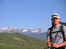
The trail was right where it was supposed to be. We found it just after a large bend in the road and laughed. Now we were ready to begin our final push on the Colorado Trail. We walked by Little Molas Lake, admired the view back towards the Animas River Canyon, and turned to the north. Even though the sun was up and poking through the clouds occasionally, I was wearing my light fleece jacket, gloves and beanie. Since we were going to be at or above treeline most of the day, I was hoping the clouds wouldn't build and bring thunderstorms.

The trail rolled along, climbing and descending through amazing patches of wildflowers. There were Larkspur nearly as tall as us, Carrots, Sunflowers, Paintbrush and Monkshood. I thought it couldn't get any better, but as we approached the Engineer Mountain Trail after several hours of hiking, fields of wildflowers opened up. I was taking photos and video every few steps as our surroundings got better and better.


Fortunately, the clouds were dispersing as we headed up the Rico-Silverton Trail and gained a pass just south of Rolling Mountain at 12,490 ft. Even though we were all well-acclimatised, the combination of high altitude and steep trails left us winded every time we gained a saddle. Even so, I felt a strong sense of accomplishment each time we crossed into a new drainage.

When we came to treeline after descending a series of switchbacks, the three of us pulled off the trail to have some lunch. We were all feeling pretty good, helped along by each other, the scenery, and the pull of Durango and the end of the trail. Robyn and I had our normal lunch of a tortilla smothered with honey. It wasn't exactly filling, but we supplemented it with Cliff Bars, trail mix, and jelly babies. We were existing on a high calorie drip, steadily taking in food throughout the day.

The trail dropped 1500 ft. in the next three miles until reaching a bridge that crossed Cascade Creek. We all had re-filled water shortly before and began another ascent, preparing to cross our third saddle of the day. We were all spread out along the trail, walking at our own pace. I would stop every 10 to 15 minutes to make sure Robyn and Keith were still doing well. Without incident, they always were just behind me with smiling faces.

While taking a short break at a creek just below the saddle that would lead us to Bolam Pass Road, we noticed all the rocks in the creek were stained white even though none of the rocks around us were that color. The three of us were all familiar with common water quality problems like giardia, but this environment and the impacts of mining also created another serious issue called acid mine drainage.

There are many abandoned mines in Colorado that have lots of pyrite, a mineral that is made up of iron and sulfur. When this mineral is exposed to air and water, a chemical reaction occurs that produces sulfuric acid. As the sulfuric acid builds, it lowers the pH of the waterway and can cause major problems with aquatic life and stream-side vegetation. If the problem is pronounced, it can make the water unfit for human consumption. It is this buildup of acid that is also responsible for the white coloration of the rocks.

When we reached the saddle, we had great views of Lizard Head, a prominent 400 ft. tower outside of Telluride. While lounging and enjoying more snacks, thunder rumbled overhead. We were above treeline near the highest point in the area. It was time to get moving.

After walking by Bolam Pass Road and Celebration Lake, we made our way to our fourth saddle of the day, this time below Hermosa Peak. It was only 3 pm and we had covered 22 miles. The three of us knew we would have to cover more miles to put ourselves in position to finish the trail two days later.

It is always nice to finish a day with a gentle downhill stroll to a campsite along a creek. This didn't happen for us on day 23. We knew we needed to get over Blackhawk Pass to find a water source for the evening, but didn't realize we would be making a climb of 600 ft. in six-tenths of mile to gain the pass. Normally, this wouldn't have been a huge topic of conversation, but at the end of a 28-mile day with more than 4,000 ft. of climbing, we were not thrilled to be going up again. Then, when we dropped into the Straight Creek drainage, there was a large group of high-school aged students right where we wanted to camp. There was nothing left in our legs, so we found a reasonable spot to camp well off the trail several hundred yards from the group.

While setting up camp, we all noticed the lack of mozzies. Swatting wildly at regular intervals to kill them had become something of an evening ritual for us while eating dinner and preparing camp. This was one ritual we were happy to have a break from. Robyn and I cooked risotto over our tuna-can alcohol stove, joked with Keith about our nice climb to finish the day, then headed to our tent for another great sleep.

After breaking camp by 6:30 am, we walked 1/2 mile down the trail and re-filled our water bottles and bladders at Straight Creek. The guidebook and maps indicated it would be our last water source for 20 miles until coming to Taylor Lake. The three of us all took one gallon of water, the maximum we could each carry. We figured we would be at Taylor Lake by 3 or 4 pm.

The trail dropped steadily for the first few miles. Just before reaching Hotel Draw Road, we ran into a group of ladies who were out on the trail with several llamas. They were Durango locals and gave us the inside scoop on where to stay and where to eat. We were getting close.

The trail rolled along, passing through some recently logged areas. We would walk through a logged section with no cover for several hundred yards, then enter a wooded section for about the same length. When we stopped for lunch around 11:30 am, the clouds had enveloped us and were starting to rumble overhead. The three of us were happy to have a break to see what the weather was going to do before heading out into another open section. Just before sitting down, I noticed a slight twinge in my right shin. My left shin, also known as Bertha, had hurt for nearly a week earlier in the trip. I hoped this new pain would disappear during our down time.

Robyn and I were munching on our trusty lunch of tortillas with honey when the skies opened up. Pellets of hail hit the ground one at a time at first. Within 5 minutes, we all had our rain gear on and were huddled under the branches of some small fir trees for cover. Thunder boomed around us occasionally even though the lightning was still in the clouds. The three of us had learned our lesson earlier in the trip about moving with thunder nearby. We were not going anywhere.

The three of us figured the storm would pass as all the others had done. We were not quite right about that. I was reclining on my pack with my poncho covering my whole body and actually fell asleep for a while. After an hour and fifteen minutes of waiting, a patch of clouds opened up and the hail stopped. We hadn't heard thunder for fifteen minutes, so decided to move on. We were all getting a bit cold and knew movement was the best answer.

The trail climbed steadily for a mile and came to a series of switchbacks. After reaching a bench with an expansive meadow on our left the clouds opened up again. This time we were not lucky enough to have dry hail pellets. It was raining full force. Again we took shelter under some fir trees to wait out the storm. Within 5 minutes, we saw several flashes of lightning and accompanying thunder. The storm was right over our heads.

We waited for the storm to pass for another hour. We all felt antsy, knowing we had only covered 15 miles for the day. Unfortunately, the next few miles along the Indian Trail Ridge were above treeline and very exposed. The guidebook warned that this area could be dangerous during afternoon thunderstorms. Our antsyness had to wait.

At first, rain dripped from the hood of Keith's rain jacket and our ponchos. After an hour it was pouring off of us. We were all getting cold and the storm wasn't moving. It was only 4 pm, but we collectively decided to put up our tents so we could stay dry.

Our tent was up in a few minutes and we were in our warm clothes within 5 minutes. Keith setup his tent just as quickly and was already beginning to make tea. Robyn and I reclined and tried to make light of the situation. This was only the second time we were really delayed by storms over the course of 24 days. We were bummed not to be moving, but knew we had been incredibly fortunate with the weather.

There was only one thing we could think of while sitting in the tent. Food. Our thoughts and conversations always drifted towards food after several days on the trail or during breaks. This was the longest break we ever took on the trail, so our natural inclination was to eat. At 4:30 we began to cook ourselves dinner. We figured a full stomach would help lift our spirits and warm us up.

By 5 pm the rain stopped, but there was no way we could make it over the Indian Trail Ridge and down to Taylor Lake before dark. We read that section was a great hike and didn't want to miss the views by hiking it in the dark. The three us were also not sure the storm was done. As our quonia cooked, I walked back out onto the trail to see what was up ahead and came to an intersection. To the right was a side trail for views. I decided to scurry to the end of it to see if the storm was passing.

When I reached the end of the side trail, I could see the outline of the high San Juan Mountains to the east. The clouds were below me and above me which created a spectacular vista. I snapped pictures and video for several minutes, then headed back towards our makeshift camp. I knew the food would be waiting.


After some talk, we decided to setup camp right where we were and call it a day. It was our shortest full-day in terms of distance covered. We knew that meant the next day would be long. The three of us only packed food for two and a half days on the trail from Silverton to Durango, so we didn't have enough to split the remaining 30 miles into two days. We would have to cover it in one go. The three of us also had to be careful to conserve our water. Each of us had about a liter and half left. That would have to see us through the night and eight miles of hiking in the morning.

We were awake early to clear and cold skies the following morning. Keith, Robyn and I had become very efficient at getting out of camp. The excitement of the final day filled all us with energy, but we knew we had lots of ground to cover. There was no time waste. We were on the trail by 5:30 am.

My shin was quite sore as we walked along. I knew that would make the day especially difficult given we would be descending nearly 6,000 ft. I couldn't figure out what I had done to aggravate it. I thought by this point in the trip my body would be well-adapted, but knew I couldn't dwell on it too much. There was lots of ground to cover and I would have plenty of time to rest after reaching Durango. Since I called my other shin Bertha, I decided this shin should get a name that started with a "B." Bartholemule fit the bill perfectly.

By 6:30 am, we had passed an intersection with the Grindstone Trail and were above treeline. When we saw how exposed the terrain was, we were all content with the decision we had made the previous day to huddle down and wait out the storm. We would have been walking lightning rods on the ridge during that storm.

When we reached a gap in the ridge, we heard some commotion to the west and saw a herd of elk moving into the forest several hundred feet below us. This was the first herd of elk we had seen on the entire trail. They bugled below us and were gone before we knew it. We all had huge smiles plastered across our faces. The sky was clear and we were seeing some wildlife. Things couldn't get any better.

Things did get better. While walking along the ridge, we saw two more herds of elk. We had gone from seeing flashes of elk in the distance to more than 100 in a matter of an hour. Robyn and Keith took pictures while I filmed them, hoping the bugles would be caught by the microphone in my camcorder.


When we made the left turn down to Taylor Lake, I took the last sip of my water. We were all fortunate the weather had improved so much. The three of us would have had a major dilemma
if we woke up to thunderstorms because we would have been short on both food and water. We would have had to re-trace our steps for 15 miles to get water, but we would have ran out of food. That was a situation we were happy to avoid.

Bartholemule hurt with each downhill step, but I was able to keep moving forward. After we treated water from the outlet of the lake and began the 1.5-mile walk to Kennebec Pass, we crossed paths with a group of ladies out for a day hike. When we told them we came from Denver and were finishing the Colorado Trail today, they quizzed us with a barrage of questions. One of the ladies gave us a homemade energy bar that tasted great. Keith, Robyn and I all felt pride in what we had done while discussing it. It was nice to share our experience with people who were genuinely interested in what we had done.

The trip wasn't over yet, though. We still had 22 miles to cover and it was already 10 am. On our way up to Kennebec Pass from the trailhead parking lot, we saw another herd of elk and I saw a coyote run across the trail. I couldn't believe we were seeing so much wildlife on our last day when we had seen so little perviously. It felt as if we were being rewarded for our patience.

Our descent into the Junction Creek watershed was not as steep as we thought it would be. The trail was well graded and easy to walk. We motored along at a good pace and covered the 6.5 miles from the pass to the bridge at Junction Creek in just over two hours. We started making predictions when we would reach the Junction Creek Trailhead and the end of the Colorado Trail. The three of us all agreed we would be there between 5 and 6 pm.

I felt ambivalent as we made our way closer to the terminus of the trail. After reaching the top of an 1,100 ft. climb over the next four miles, we could see down towards Durango. I felt great about what we were about to accomplish - nearly 500 miles of walking through our new home state. I was ready for a nice shower, clean clothes, good food, lots of sleep, and water that I didn't have to treat with chlorine. The end felt like it was coming at just the right time.

Even given the fatigue I was feeling, the pain that Bartholemule was bringing, the anxiety caused by waiting out lightning storms, and the stench from wearing dirty clothes everyday, I knew that something very special was ending. I loved being out on the trail with clear, easy to define goals. Every day I knew I would be out walking with friends and seeing some of the most amazing mountains in the world. Robyn and I had made it together with no major problems. Our relationship felt as strong as ever, something not all couples experience after an extended period together in the backcountry. We had made a great new friend in Keith, someone we would keep in contact with and perhaps meet again for another adventure. There were lots of other great people we had met like Mike and Debbie. I was sad knowing this would all be done when we checked into a hotel, changed into our clean clothes and ate at nice restaurant.

The end of the trail came quickly. We had walked from an alpine, tundra environment down through fir forests and into pine forests as we neared Gudy's Rest and the second bridge over Junction Creek. When we made it to the bridge, we told Keith we only had 1.6 miles left when we really had 2.6 miles left. Keith knew it wasn't right, but we got a great response from him.

We all walked along in our normal fashion. I was out in front, followed by Robyn, then Keith. We reached a large boulder with cairns on it that were set up by people who we presumed had finished all or part of the trail this summer. We added another for the three of us.

We passed several hikers and, before we knew what to say, were standing at the trailhead sign and the end of the trail. The three of us had started on the same day within an hour of eachother and finished together 25 days later. There was nobody there to congratulate us or throw a big party. We took photos, a few last bits of film, and congratulated eachother. We walked to the end of the parking lot and found a ride into Durango within 10 minutes. Before we knew it, we were being driven down the road at 30 mph. Our life as backpackers moving at 3 mph on The Colorado Trail was now our previous life.


The woman who drove us into Durango was unbelievably friendly. She dropped us off on the main street after taking us to several hotels that were already full. Keith and I figured she was close to offering us a room in her house to stay in, but we would not have been comfortable with that. Keith found a hotel room first, then we found one across the street. After showers and a quick call home, we went out to eat a Mexican restaurant. They treated us like kings after Keith told them what we just accomplished. They even brought us a dessert of ice cream and fudge on the house that was way too big for us to finish. We took the trolley back to our hotels and planned to meet up the next day before Robyn and I were to head back to Boulder. Robyn and I were asleep just after the light went out, knowing we had just walked across an amazing state that we could now officially call home.


Still to come...Final thoughts, life after the Colorado Trail, and gear lists.


Sunday, September 20, 2009

The Colorado Trail: Day 19-22

Whenever I camp in a day-use only area or sneak into a campground in the middle of the night without paying, I am always a bit nervous that I will wake up to see the area partitioned off with crime scene tape and rangers waiting to take me away. OK, maybe they would just ticket me, but it is still something I worry about in those wee hours of the night when I wake up momentarily after rolling off my sleeping pad or hearing something outside. Fortunately, I have never been caught, and this morning proved no different. After a breakfast of cold cereal in bed, we were back on the trail by 6:30 am.

The three of us had another big day planned. We would start at Spring Creek Pass and make our way to Coney Summit, the highest point on the Colorado Trail, then drop into the Pole Creek drainage where we would find a place to camp. About 10 minutes after leaving camp, we came to a junction with a map and a sign below that said "You Are Here." It was good to know we were there.


In the first 6 miles, we climbed more than 1000 ft., saw a huge flock of sheep with two watch dogs and crossed Jarosa Mesa, another completely exposed stretch of tundra above treeline. The trail on Jarosa Mesa was nonexistent, so we walked from cairn to cairn. We all occasionally looked back to the east and could see Snow Mesa moving further and further into the distance, something all three of us were very happy about.

The trail climbed several bumps along the Continental Divide with spectacular views of the surrounding San Juan Mountains. As we made our way towards Coney Summit, the wind picked up around 10 am. Whenever I saw that we were coming up to a gap in the ridge where the wind would really be howling I would take my hat off. I knew if I didn't, it might soon be flying down the mountainside with me trying hopelessly to chase it down. There were several climbs where I would turn my hat backwards when we went into the wind and turn it back forwards at the next switchback. The three of us looked pretty comical leaning into the wind, trying to make headway towards Silverton.

We reached Coney Summit, elevation 13,240 ft., just after noon. We actually didn't even know that we were at a summit. It was more like a little bump on the ridge with the distinction of being the highest point on the 485-mile trail. Trying to keep our sense of humor and find a sheltered place from the incessant wind, we didn't celebrate on top for long. We dropped down 800 ft. in the next mile to Carson Saddle. On the way down, we had to walk a steep, loose section of 4x4 road that we all kept slipping and sliding on. It was time for a break.


The mining remnants in the San Juan Mountains are everywhere. There are old structures from the late 1800's and early 1900's that are still standing even though this part of the Rocky Mountains is notorious for having ferocious winter storms. There are many mountainsides that were once obviously mined with piles of loose rock everywhere. However, the most amazing remnant from the heavy mining times is all the roads. There are dirt roads criss-crossing these mountains in the steepest, seemingly least accessible locations. It is unbelievable to sit above 13,000 ft. and look down on alpine tundra with so much infrastructure from a time past.

When we left Carson Saddle, the trail climbed up a valley and over an unnamed pass at 12,920 ft. The valley was one of the most spectacular that we had ever seen. There were wildflowers and grasses, huge mountaintops with gendarmes (pinnacles) of volcanic rock, and expansive views of the mountains to our east. We floundered just below the pass for 20 minutes, taking in some nice afternoon sun, joking around with each other, and enjoying the experience we were having. I was wishing this could last forever. More miles called though, so we were soon up and heading down into the Pole Creek Drainage.

After crossing the pass we also crossed the imaginary line marking 20 miles for the day. Robyn and I were feeling good, our bodies adapting well after nearly 3 weeks on the trail. However, this was the point in the day when Keith's foot would start to hurt. When we reached a trail junction with Pole Creek, Keith decided to try the one shoe-one sandal technique. Even though I felt terrible for him because he was hurting, I couldn't help but laugh when I saw him walking down steep, narrow, rocky trail like this. He was incredibly tough and amazingly good-humored. Nothing seemed to ever get him down, not even having to hike with one sandal and one shoe. He was going to make it to Durango. It was great being able to hike with him.


The trail dropped down towards Cataract Lake, then turned back to the west after passing a small, unnamed lake. We considered camping there, but decided we could put in a few more miles. Keith decided the one shoe-one sandal method wasn't working, so he put his other shoe back on. Robyn and I both laughed with him.

The trail dropped and passed several good campsites with nearby creeks, then headed out along a scree slope up towards another pass. We were all confused. The guidebook pages Kieth had photocopied and the databook all said we should be dropping all the way to Rio Grande Reservoir. That was to the south, but the trail we were on was headed to the west and rolling up and down.

After talking things over and looking at the sun getting closer to the mountainous horizon, we all decided to head back a quarter mile to the last good spot we saw to camp and figure out what was going on there. While we cooked dinner and gathered water, I looked at the topo maps and found we were headed in the right direction. The trail had split away from the Pole Creek drainage. The confusion came because the guidebook and databook said we were supposed to go down the Pole Creek drainage. I was confident the map was right and the books were wrong. We figured there must have been a recent re-routing of the trail and the maps were up-to-date but the guidebooks were not.


The next morning brought more beautiful blue skies. We quickly reached the crest of the pass we were looking at the previous evening and contoured around a small peak. There were cairns everywhere! Many of them were bigger than us. We all agreed our premonition that the trail had been re-routed to avoid the big descent to the reservoir and big climb back up to Stony Pass was correct. I took pictures next to many of the cairns, impressed by the determination and dedication put in by trail crews to make them.

While dropping down to the middle of a drainage, we came across a group campsite with about a dozen tents scattered about the tundra. The group was there doing just what we thought was happening; they were working on the Colorado Trail trough this new section. Keith, Robyn and I were all relieved to get an official word we were on the right trail. They described to us that the trail followed the Continental Divide for the next 7 miles to Stony Pass. In addition to avoiding the descent to the reservoir and big climb to Stony Pass, this new bypass also avoided the multi-use trail going down to the reservoir. They said the old Colorado Trail through Pole Creek was not very enjoyable. We were very grateful for their efforts to make the trail better.

The ridge walk didn't prove easy, though. We would climb, then descend, then climb, then descend. The trail was steep, rocky, and occasionally nonexistent. However, there were always cairns to follow if the trail wasn't there. When we stopped to enjoy the surroundings, as we often did, we were amazed with the colors in the mountains, the wildflowers all around, and the perfect mountain weather. Things were looking good.

There was a small bit of trail magic after passing Stony Pass. We all grabbed some candy from the bucket hanging off the side of an old mining structure and signed the guestbook. Like the past few days, the wind started to pick up around 10 am. Since we were above treeline, there was no way to get out of it. We all just put on wind breakers and kept moving forward.

Arrow and Vestel Peaks came into view as we walked across another mesa above 12,000 ft. We all looked ahead towards Elk Creek, knowing there was huge descent in front of us. The topo map showed the descent as a series of switchbacks all crammed together. The guidebook described it as nothing short of spectacular. We were all excited.

After cresting a small rise, the switchbacks came into view. They zigzagged down an amazingly steep slope. There was a group of people at the top of the descent and as we approached them we saw they were forest service workers fixing trail signs. They had packed their stuff in with llamas and were working on making sure the trail junctions were clearly marked in the area. Keith put down his pack to get a snack before heading down Elk Creek and realized one of the sandals he kept strapped to the outside wasn't there.


"Oh no, I must have dropped my sandal!" Keith exclaimed with the rangers right there. I cringed when he said that, wishing he would not have said that in front of them. She chuckled at him and said she wouldn't make him go get it or fine him for littering. Keith got lucky, even though he was unlucky to lose his sandal. The ranger offered to ship it to him if someone found it and delivered it to the lost and found box at the Forest Service office. For a moment, Keith thought it was a good idea and gave her his business card. Then he realized he lived in Oman and shipping for a single sandal would cost much more than several new pairs of sandals. The meeting was funny, if not a bit tense for a moment and a little awkward.

The drop down Elk Creek was spectacular, just as the guidebook described. We made our way down the switchbacks, then past an abandoned mine shaft and cabin and down the drainage. We came to treeline after 30 minutes, the first trees we had been in since the early morning. It was nice to get out of the sun. However, as soon as we sat down, flies were all over us. It was the first encounter we had with flies. We didn't like it, so we got back up and kept moving.

That afternoon we hiked down the whole drainage, eventually crossing the railroad tracks of the Durango and Silverton Narrow Gauge Railroad and finding a good campsite along the Animas River. We had dropped 3500 ft. in 7 miles since meeting the rangers and losing Keith's sandal at the top of the Elk Creek Drainage. We had passed several hikers in the last few miles and were extremely happy to be 4 miles from Molas Pass, the place we would catch a ride into Silverton the next morning.


Robyn and I took turns watching the stove while the other went and rinsed off in the Animas River. Keith was sitting on a rock next to the river, cursing at his clogged water filter. I was happy to have Aqua Mira water purifying drops. I have always hated water filters - heavy, slow, and prone to clogging. Keith was impressed that the Aqua Mira drops didn't have an aftertaste after giving up on his filter for the evening. In this case, we were living better through chemistry.

After eating dinner, one of the hikers we passed a few miles from the river showed up at our campsite. Her name was Debbie and she was also a school teacher. She had hiked the first half of the Colorado Trial the previous year and was finishing the trail this year, going from Salida to Durango. Debbie offered us some of her extra food and had dinner. We all chatted and ended up in hysterical laughter at one point. The four of us were all overtired. It was time to take a day off.

Keith, Robyn and I were out of camp by 6:15 am the next morning. Debbie was still in her sleeping bag as we wished her luck and told her we would likely run into her in the small mountain town of Silverton. She planned a more leisurely morning and figured she would get into Silverton around noon.

The three of us crossed the bridge over the Animas River, then made our way up the well-worn, well-graded trail nearly 2000 ft. to Molas Pass. The climb went quickly as the town pulled us closer and closer. Whenever a town is near on a long-distance hike, it acts like a magnet. When you get close enough, it will just pull you along regardless of how tired and sore you may be.


After an hour and a half, we made it to Molas Pass and Hwy-550. Robyn immediately stuck her thumb out and Keith and I hid behind her. Within 5 minutes we had a ride. The woman who drove us down to Silverton was headed over Red Mountain Pass to climb Mt. Sneffles. She surely could have out-hiked and out-climbed any of us.

Robyn, Keith and I were all beaming when she dropped us off. It was so nice to be in a town after 6.5 days of hiking. We all had a breakfast burrito and lounged in a local restaurant called the Steam and Steel Cafe. It was delicious. There was a hotel nearby with an apartment open that the three of us split. After showering and changing clothes, we all felt like new people. Our resupply boxes were waiting at the post office. We were glad to have made it to town before it closed so we could get an early start on Monday morning but we were all ecstatic to have most of Saturday all of Sunday in town.

Later that afternoon, Keith found Debbie. She was staying at the same hotel as us. The four of us went out to dinner at a local pizza restaurant and ate until we couldn't eat anymore. Robyn and I overestimated our appetites, ordering a large pizza each. This time we could only eat half a pizza each at one sitting. We took the rest of the pizza to go, though, knowing we would be hungry again soon.

The next morning we struggled to get out of bed, but couldn't sleep past 6:30 am. Our bodies had gotten used to waking up with the sun. I watched the British Open on TV, unfortunately seeing Tom Watson lose his lead and eventually a playoff to Stewart Cink. After that, I spent most of the afternoon napping.

That evening Debbie came over and we had burritos for dinner. The four of us enjoyed each other's company and stories. It was always great to meet new people on the trail. This time that new friendship carried over into town but we knew that this evening would likely be the last time we would see Debbie. Keith, Robyn and I planned to hike the final 73 miles from Silverton to Durango in 3 days while Debbie planned to do it in 5.

The trail, and our adventure, was in full gear. We had made the push to Silverton from Salida and all of us had arrived in good spirits. However, as we hung around Silverton and took in the moment, we began to realize that our adventure was also nearing its finish.


Saturday, September 12, 2009

The Colorado Trail: Day 17-18

Mike, Keith, Robyn and I all woke up to blue sky on our 17th morning on the Colorado Trail. The previous day had its ups and downs and a great finish at Apple's Trail Angel Camp, but we didn't quite cover the mileage we had hoped to. If Robyn, Keith and I were going to make it to Silverton in 4.5 days, this needed to be a day where we put a bunch of miles behind us.

Keith and Mike were out of camp 15 minutes before us. After walking down Lujan Creek Road, we caught them while they searched for the trail after walking a half-mile down Hwy-114. We eventually found it across the highway on the other side of a large pullout. It was not a very well-marked intersection. The trail continued into a dewy meadow and passed over Lujan Creek.

After turning to the south, we came upon a styrofoam cooler on the side of the trail. Trail magic again! This time there were sodas waiting for us, but none of us drank any because it was still chilly outside and we had our fix the previous evening. The trail steadily climbed an old, abandoned logging road to a cul-de-sac and climbed 250 ft. in 0.2 miles to a saddle. It was a short but steep section. Whenever a trail gains 1000+ ft. per mile you can count on some chinscraping.

Keith hiked along with Robyn and I down Forest Service Road 876 while Mike walked alone a bit behind us. As we talked about our itineraries, we realized that we would have to pick up the pace a little. I had originally planned on making it to Silverton on Saturday evening, but thought it would be a good idea to get there on Saturday morning so we could get our re-supply from the post office before it closed at noon. To make it, we really had to high-tail it. I figured we needed to cover 30 miles today to give ourselves a small buffer heading into San Juan Mountains where the terrain would be much steeper and mostly above treeline. Keith had never hiked 30 miles in a day before, but was excited by the opportunity.

Mike caught us soon after and the four of us walked together talking about anything and everything. The trail, which was currently on a dirt road, rolled through sagebrush with spectacular fields of wildflowers. There were paintbrush, bluebells, sunflowers, penstemons, asters and geraniums all around. When it came up that I played the banjo, Keith figured we should have a duel with him on the guitar. It would have been fun, but I'm sure he would have left me in the dust.


Walking along the edge of Cochetopa Park towards Saguache Park Road, Robyn and I noticed something rather funny. Keith's pack was not sitting squarely on his back, but angling rather dramatically to the right. We teased him mercilessly. Whenever he looked back at us, we made sure to act like we were filming or taking pictures of him. Most of the time we actually were! Eventually Keith got the pack straight, but not before we all had a few good laughs.

The views around us opened up dramatically. There were mountains in the distance, but the landscape around us was nearly flat for the first time on the entire trail. We took a break under a lone tree for 20 minutes so we could have a snack and get out of the sun. Eventually we got back on our feet and continued down the road until meeting Saguache Park Road. The four of us had covered 15 miles before noon.

All of us were looking for a water source and hoped Monchego Creek would be flowing. It was flowing slightly, albeit across the dirt road with cow patties all around. None of us were that low on water to even consider drinking it. After taking a right turn, the trail rolled up and down for the next several miles through sagebrush and intermittent fields of wildflowers. Mike decided to stop for a break before Ant Creek and wished us luck. His plans were to stop in Creede two days later and he didn't really want to cover big miles on any one day. We didn't think our paths would cross again.

The Colorado Trail Guidebook said this was one of the least scenic sections of the trail and we would be happy to get through it. I disagree. Even though we weren't in the mountains, the views were expansive and the flowers were in full bloom. The trail wasn't very steep for the most part, allowing us to stretch our legs and walk at a nice pace for most of the day. The toughest part of this section was the heat and lack of drinkable water.

Two hours after passing Monchego Creek we approached another saddle. While talking to a couple on the trail, Mike walked up from behind us with a wry smile. His break didn't last long when he realized he needed to keep moving to avoid running out of water with no supply nearby. Robyn and I walked together ahead of Keith and Mike up to the saddle and down the other side. Shortly before reaching Cochetopa Creek, we both took the last sips of water we were carrying. Our timing was spot on.

While coming down the hill to Cochetopa Creek we saw a family that had driven in to spend the afternoon fishing and playing in the water. I felt a certain sense of pride having walked all the way here from Denver while they had driven in. Robyn and I went upstream of them and lounged by the running water. Amazingly, the mozzies were nonexistent. We re-filled our water and gave our clothes a good clean.

Keith came walking towards us with a huge grin on his face. We figured he was happy to see the water, which he was, but he also had a funny encounter with the folks downstream of us. While he was walking down the hill, a woman with the family was changing on the other side of the car from Robyn and I. That side of the car, though, was the side Keith could see. The woman shouted that a hiker was watching her and how embarrassed she was. Keith laughed. He knew she was being paranoid and that it would become another good Colorado Trail story for us.

When Mike came down the hill the three of us were sitting in the grass along the edge of the creek joking about how the woman might come after Keith. We lounged in the late afternoon sun for nearly an hour, enjoying the time off our feet.

There were more miles to cover, though. Shortly before we crossed over Cochetopa Creek on a series of wooden planks, Mike pulled off the trail to setup his camp. This time we wouldn't see him again. We all wished each other good luck. Keith, Robyn, and I were bummed not to have him along anymore, but we knew we had made a good friend. People say that a day spent together on a trail like this is like spending a month together in the real world. You get to know people really well, really quickly.


The walk up Cochetopa Creek was pleasant, but the three of us were getting tired. When we reached the Eddiesville Trailhead and found a great campsite nearby, we stopped to camp without hesitating. We covered more than 30 miles. Keith was smiling, maybe from the accomplishment or maybe because the day was finally over. I think it was a little bit of both.

Robyn and I always split our camp tasks. She would set up the tent and get water while I would cook dinner. We usually had everything set up and dinner ready within half-hour. That evening we had quinoa with veggies and slivered almonds. It tasted unbelievably good. We both ate enormous portions followed by half a bar of dark chocolate.

Day 18 promised to bring more challenges. When we woke up, I was a little nervous to see clouds in the sky before 6 am. Usually that meant thunderstorms were brewing. The day started at 10,32o ft. and the trail would climb to the saddle of San Luis Peak at 12,600 ft. over the course of the first 9 miles. We were entering the San Juan Mountains, the most rugged and remote of all the mountains in Colorado.

After only a few minutes, we crossed into the La Garita Wilderness and were met with imposing views of the mountains ahead. The San Juan Mountains are well known for their rugged beauty and rich mining history. There are only a few towns scattered about the 12,000+ square miles that this part of the Rocky Mountains cover, including Creede, Lake City, Ouray, Silverton and Telluride. In the late 1800's when mining was in full force in this area, there were thousands of prospectors who lived here hoping to strike it rich. Silver, gold, copper, and lead were all found in this heavily mineralized region. Now, though, tourism is the driving force behind local economies with only small-scale mining operations that are very widely dispersed.

The climb up to treeline and the saddle of San Luis Peak was not as steep as we had feared. Our bodies seemed to be adjusting to the daily routine of hiking for 10-12 hours. Bertha hadn't bothered me at all in a few days and Fred and Nigel were not annoying Robyn. She was still dealing with Normalena (her left knee) on the downhills, but even Normalena was not as intense as a week before. We were feeling very good about this positive trend.

The clouds were still lingering as we climbed up and down the mountain ridges. We would drop down several hundred feet on steep, rutted trails only to climb up seemingly steeper, more rutted trails. Even though we were all well acclimated, we frequently had to stop and pant to try to catch our breath above 12,000 ft. It was great fun.

The views around us were amazing. San Luis Peak, a fourteener, stood just above us to the north. Mountain peaks rose all around with red tops stained from iron and green slopes of grasses and shrubs. We continued on. Up, up, up, then down, down, down.


After crossing the West Mineral Creek Trail, we looked out at an open ridge and knew that we would be fully exposed to the weather for the next few hours of hiking. Snow Mesa lay further ahead, a fairly flat 3 mile expanse of tundra at 12,280 ft., with no easy escape from storms. The clouds looked semi-threatening all day, but nothing had happened yet. We decided to go for it.

The three of us moved well in the alpine terrain. I hiked out in front, followed by Robyn, with Keith close behind. We normally hiked in this order and usually there was a bit of separation between each of us. Each of us had a comfortable pace to walk at and breaking that pace to stay close to one another could be quite tiring.

The trail climbed to a saddle the turned to the south where we walked along a flower-covered plateau. Eventually we reached another saddle at a junction with the Old Skyline Trail. The Colorado Trail veered to the west and down to Snow Mesa.

Snow Mesa began as a flat, vast grassy expanse with mountain views in the distance. A towering cumulus cloud lingered to the east. Every time I looked back to make sure Robyn and Keith were doing well, the cloud seemed to be moving in. Fortunately, it stayed far enough away.

Unfortunately, the wind did not stay away. It blew into our faces mercilessly. The only way to combat it was to put our heads down and keep moving forward. The mesa was actually not entirely flat, dipping rather steeply in and out of small drainages. The 55 minute, 3-mile walk proved to be the most unpleasant of the entire trip. We hardly spoke a word to each other and had no way to get any respite from the wind. All of us were glad, though, that we didn't encounter a thunderstorm out there.

Robyn and I were waiting for Keith at the edge of Snow Mesa as he crested the final rise. I filmed him as we were both laughing, completely worn out. Keith thought we were enjoying ourselves but was relieved to find out we both didn't have a good time on Snow Mesa. He later admitted he had pictured the three of us cruising across the mesa side-by-side enjoying the early evening together. That didn't end up happening, but we all made it safely across and kept moving forward.


Keith had developed some blisters over the previous days and was having problems with his foot each day after about 20 miles. The walk down to treeline and Spring Creek Pass was a welcome relief for Robyn and I, but Keith was not in good shape. His foot was searing in pain. He ended up borrowing Robyn's trekking poles for the 2-mile, 1300 ft. descent. All three of us were ready to end a long day.

We could hear cars long before we could see them, but when we made it to Spring Creek Pass we all smiled with jubilation. The parking lot across the highway said the area was for day-use only even though our maps and guidebook indicated it was a campground. There were obvious campsites behind the parking lot. We had nothing left in our legs and there was no more water for several miles, so we put up our tents behind some trees and enjoyed our dinner on the nearby picnic benches. The three of us were all sound asleep before the sky was completely dark.