Monday, August 31, 2009

The Colorado Trail: Day 11-14

Each morning since Bertha joined me, I would get out of bed and gingerly walked around for a minute. I always hoped that somehow she would have found something better to do than continue to pick on me. So far, though, Bertha was hanging around. Since she wasn't getting worse, I figured the best thing to do was keep moving forward.

Robyn and I were out of the cabin by 5:45 am. After thanking our coffee percolator for a well-cooked dinner the previous evening, we started the walk back up the road to the underpass on Hwy-91. While coming into Twin Lakes the previous day, we stuck our thumbs out trying to hitch hike the mile into town. Walking down a road with traffic whizzing by is not nearly as pleasant as walking through a flower-filled meadow or over the crest of a mountain pass. We had no luck the previous day, but that didn't deter us from trying on the way out of town.

Miraculously, the third car that came by stopped for us. However, after we drove off, he was so busy telling us about his plans to hike up Hope Pass that he drove right by the underpass and our trail. We asked him to stop, but he said he knew the trail was just a bit further up. After another 30 seconds, he pulled the car over, came to a stop, and let us out next to the power plant, oblivious to the fact he took us too far. We thanked him rather begrudgingly, turned around, and walked 15 minutes back towards Twin Lakes to begin our next segment.

The Colorado Trail around Twin Lakes nearly is just that. Robyn and I walked for more than an hour through sagebrush near the north edge of the west lake, then made a full 180 degree turn at the lake's outlet and headed back in the other direction on the other side of the lake. A circumnavigation of the lake looked likely, but we eventually turned uphill and headed up a nearby ridge.

Nearly every time we took a break, we could count on one thing. We could also count on that one thing every time we set up camp, or every time we had a meal. That one thing, actually, was more like a few hundred things. Mosquitoes. Robyn called them mozzies. They always seemed to be there. After hiking 23 miles and just wanting to enjoy the sunset, there they were. Bzzzzz. Bzzzzz. Bzzzzz. When we wanted to cool our feet off in a nice, peaceful mountain creek, there they were. Bzzzzz. Bzzzzz. Bzzzzz. We tried some lavender bug spray, but it only seemed to work when it was still wet. After drying, there they were. Bzzzzz. Bzzzzz. Bzzzzz. Several locals told us it was the worse mosquito season they had ever seen. There were times when we each felt as if our bodies were just one big bug bite.

After a steep downhill to Clear Creek, we began a series of climbs and descents while headed due south on the trail. We entered the Collegiate Peaks Wilderness Area, aptly named because the first men who climbed these peaks named them after their university alma matter. The trail gained 2700 feet in 4 miles to gain a ridge off of Waverly Mountain, abruptly dropped 1200 ft. in the next 1.5 miles, then climbed 1400 ft. in the following 2.5 miles to gain a ridge off Mount Harvard. The trail felt like a roller coaster. It was rather difficult to build a rhythm in our hiking because as soon as we would feel good going up, we would be cresting a ridge to head back down.


That evening, after 26 miles of hiking, we made it to Frenchman Creek where we had decided we were going to stop for the day. There was another backpacker camping along the creek already, but he encouraged Robyn and I to set up our camp nearby. We had a nice conversation with him, but were amazed to hear what he had to say.

The previous year he had hiked from Denver to Twin Lakes and this year he planned to hike from Twin Lakes to Silverton. We never did figure out why he wasn't trying to get to Durango to finish the whole trail. What astonished us, though, was the fact he was trying to cover his proposed route in 14 days in a single push without re-supplying. He was carrying 14 days worth of food in his pack! Robyn and I were trying to avoid carrying 3 days worth of food at a time because food is heavy. Most people count on eating two pounds of food per day, and that is if you pack well with calorie-dense food. We never did see his pack fully loaded, but we presumed there may have also been a kitchen sink and a small library stashed in there.

When I looked at my pack, which had a base weight (weight minus food and water) of about 10 pounds, I felt very good about following a lightweight backpacking philosophy. Our backpacks were made by the company GoLite and weighed less than 2 pounds each. I normally just use a tarp for shelter, but on this trip we brought a very lightweight tent, mainly to protect ourselves from mosquitoes. My sleep system consisted of a one pound sleeping quilt rated to 20 degrees Fahrenheit and a Ridge Rest sleeping pad (which I had cut up earlier to make padding for our shoulder straps - it was working exrememly well). Robyn had a light, down sleeping bag and a short Therm-a-Rest self inflating pad, together weighing about 3 pounds. We carried aqua mira water purifying drops to avoid the weight and hassle of a water filter and ponchos to keep us dry in the rain rather than full rain gear. For warmth, Robyn brought a GoLite down jacket along with a mid-weight fleece and long underwear. I only brought long underwear and a lightweight hooded fleece. When I got cold in the evenings, I either draped my sleeping quit over me or went to bed. Both of us were wearing lightweight synthetic socks and running shoes.

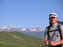
Being a bit of a gear head paid off while we were on the trail. Even though we were both having aches and pains, we were moving well. In fact, we were several miles ahead of our itinerary. The following day, our 12th on the trail, began with 6.5 miles of downhill to the North Cottonwood Creek, then climbed 1600 ft. in 3.5 miles to a ridge off Mt. Yale. The views south along the spine of the Sawatch Range and the Collegiate Peaks were unbelievable. Our roller coaster continued as we descended 2800 ft. in the next 3.3 miles.


After a quick snack at North Cottonwood Creek and passing Rest Stop, the CDT hiker we met earlier below Kokomo Pass, the trail rolled along for the next dozen or so miles in a southeasterly direction. The wildflowers continued to be amazing and the clear skies overhead were a welcome sight. By 3:30 pm, we had covered 24 miles and decided to continue on until reaching Chalk Creek. Earlier in the day we had seen several trail registers where Keith had signed in and left us notes wishing us good luck. We knew he was ahead of us, but not exactly sure how far. Robyn and I both hoped we would eventually catch him so we could share more stories.

The last 6 miles of the day were on roads. There was a dirt road for about a mile, then we walked a paved road with moderate traffic for about 4 miles. Those 4 miles felt like 10. The views were not great, cars were whizzing by, and grass seeds kept sticking into my socks when I walked on the dirt just off the highway. This road walk was a major low point for both of us so far. It didn't help that it was the last sixth of our first 30 mile day. Bertha was especially sore on the pavement, probably exaggerated by the fact we were both ready for a nice horizontal rest.

Mt. Princeton Hot Springs is a big draw for backpackers on this section of the Colorado Trail. Robyn and I have never been big fans of hot springs in general, though, so we kept walking until we turned off the black top onto CR-291. As we passed a family playing frisbee in their backyards, a huge swarm of mosquitoes that must have been programmed to attack thru-hikers swarmed around us. Even though it was still quite warm out, we both frantically put on our long pants and fleece tops. Robyn put on her head net and I pulled my hood as far over my forehead as I could. We continued moving forward, but at a speed closer to a run than a saunter.

The family playing frisbee only 100 meters from us seemed to be enjoying the evening, not engaged in full-on battle with the mozzies like we were. The children didn't even have shirts on! We figured they must have been covered in 100% DEET, something Robyn and I both try to avoid. Since it is a neurotoxin, we both would prefer to wear long clothing to protect ourselves from mozzies rather than apply that to the largest organ in our body.

Shortly after, we made it to the Chalk Creek Trailhead. We opened the Forest Service trail register and found, to our surprise, that Keith and Tom had not signed in yet. In the course of the day, we had managed to pass their last stopping point. Robyn and I both figured he had stopped right here and would be passing through in the morning.

We were correct. At 6:15 am, while we were taking our tent down, we saw Keith and Tom walking towards us on the trail. The four of us chatted for a few minutes about the past few days and what our upcoming plans were. Only 21 miles lay between us and U.S. Hwy-50 where we all were going to head down to Salida. While Robyn and I planned to take the next day completely off, Tom and Keith would keep pushing on.

The trail rolled up an down for most of the day, reaching its high point while intersecting the Mount Shavano Trail at 9880 ft. None of us even considered going up this fourteener that climbs 4300 ft. in 3.5 miles. Instead, we all were focused on Salida. Robyn and I talked about food most of the afternoon. In particular, we talked about pizza and just how much of it we planned to eat. Even though we were eating well on the trail, there was just no way to keep up with the calories expended when hiking 25 miles per day and sleeping outside. The town was near and we were feeling its pull.

For most of the day, Robyn and I hiked separate from Keith and Tom. However, we frequently took breaks and the two of them would catch us and we would all talk in good humor. The company and camaraderie was appreciated. At one point in the day, just before we had lunch around 11:30, we came upon a couple who had a llama hauling their gear for them. I had seen seen pictures of llamas in the backcountry before, but this was the first time I got to see it. It looked like slow going though, since the llama stopped frequently and didn't move much faster than one mile per hour.

By the end of the day, Bertha we actually beginning to show her first signs of improvement. I could walk and think about other things than my shin for the first time in 5 days. However, Fred and Nigel were bothering Robyn and her calves began to tighten up. She was forced to a shuffle as we crested the final hill and dropped down to Hwy-50. This was the most worried I was about her so far. I knew we had a zero day coming up and she had been dealing with other aches and pains, but the next section of the trail covered some very remote, inaccessible mountains. The only thing we could do was see if some down time and lots of pizza would help.


When we made it down to the highway, I stuck my thumb out to the passing cars. There was no chance we were going to walk the 13 miles to Salida on a major road. Fifteen or twenty cars passed right by. After Keith and Tom walked towards us across the highway, Keith told me to get out the way. He said Robyn should be the one with her thumb out trying to get a ride. Not surprisingly, he was right. The first car that passed pulled over and picked us up. We all laughed and again wished each other good luck. This time it seemed rather unlikely we would cross paths again since they would be 20 miles ahead of us after our upcoming day of rest. Tom's wife was on her to pick them up and take them into town. Keith hoped to find us after we told him we would be staying at the Simple Hostel in Salida.

Unbelievably, the family that picked us up was staying at the hostel. Charlie and Melinda and their son were in town for a few days before heading back to the east coast where he was a teacher in Massachusetts. They were incredibly friendly and courteous; none of them even mentioned anything about how bad we must have smelled.

After making it to town and checking into the hostel for one night, Robyn and I went to the outdoor shop in town to buy some new socks. In addition, Robyn bought a pair of Superfeet insoles, something I already had in my shoes. We both hoped that they may help silence Fred, Norman and Normalena and her calves that were just now starting to relax. Later, we had our pizza - one large each. There were only two or three slices left over, and I ended up eating those two hours later while using the computer at the hostel. We had a great stay overnight, falling asleep before 10 pm.

The following day was spent moving as little as possible. The beer festival was in town, but unfortunately that meant the hostel had no room for us. I found a place to stay back up near the trailhead called the Monarch Mountain Lodge. The owners of the hostel, feeling bad that they had to turn us away, actually drove Robyn and I the 15 miles up the mountain to the lodge. It was incredibly generous. We were bummed to leave their hostel and would highly recommend it to anyone visiting Salida.

We spent that afternoon napping and watching movies. Robyn did a load of laundry, but had no spare clothes so she waked around the hotel in her down jacket and bath towel asking random people if they had any spare quarters for the washing machine. It was a sight to see. Keith said he always wanted to anchor time on days off. Robyn and I both felt that way. While we loved being on the trail, taking a day off our feet felt so good. Soon it would be morning, and we would begin heading towards the San Juan Mountains which many hikers had told us would be the most scenic and most challenging of the entire trail.


Sunday, August 30, 2009

The Colorado Trail: Day 8-10

Logically, taking a day and a half off after hiking from Denver to Copper Mountain should have refreshed and re-energized us. Somehow the opposite seemed to occur. We got back on the trail at 6 am on July 5 and felt uncomfortable with our packs right from the start, fidgeting and trying to get them to fit just right. My hips felt bruised and sore from my hip belt, making walking the first few miles very uncomfortable. Both of our heads felt hazy and our throats were dry. The only way to get back in the rhythm of hiking was to keep moving forward. Eventually things must get better, we thought.

Two miles in, things got slightly better for me. We walked by the Copper Mountain Golf Course and when I found myself on one of the tee boxes early in the morning, I thought some golf might do me good.


Robyn and I shortly thereafter began a long, steady climb that would take us over 12,000 ft again, but this time we would stay up above tree line for more than 3 miles. With the early morning low clouds and rain, we were both a bit concerned that stronger rain, hail, strong winds, or maybe lightning would be waiting for us. I kept looking around at the clouds, trying to convince myself that it all would work out.

After 2,000 ft. of climbing, we saw a hiker coming down towards us with a small daypack on. He introduced himself to us and pointed up to his friend heading in the other direction. It was Keith up ahead! We had taken different days off but were right on the same schedule. Tom, Keith's friend, was headed back to Copper Mountain where he would drive his car around to Tennessee Pass and pick up Keith. It was nice meeting him, but Robyn and I were both excited to catch Keith and see how his climb over the Ten Mile Range had been.

We passed Searle Pass at 12,040 ft., then walked through intermittent patches of snow and rock-hopped several small creeks. Keith was in view most of the time in front of us, but judging distances above tree line is always tricky. I thought we might catch him in twenty minutes from when we first saw him, but we never seemed to make up any ground, regardless of how fast we moved. The trail rolled up and down over the next few miles following posts driven into the tundra with Colorado Trail confidence markers on them.

We crested Elk Ridge, the highest point of this segment at 12,280 ft., and dropped down to Kokomo Pass and the headwaters of Cataract Creek. As we descended, the clouds quickly darkened, and before we knew it hail was beginning to pelt us. Robyn and I both put on our ponchos, then our gloves as our hands started to get cold, and moved as quickly as we could to stay warm.

After 15 minutes, and Robyn telling me I looked like a wizard with my poncho on, the hail stopped as quickly as it began. At the time, I was wishing I was a wizard. My right shin started to feel a bit twingy as we crested Searle Pass. By now, it felt like I was being stabbed with each downhill step in the lower part of my leg. I hobbled quickly down the mountainside, trying to keep up with Robyn and thinking of what I could call my shin to begin the dissociation process.

When we were nearing tree line at 11,600 ft., Keith called to us from below to tell us to stop and read a plaque we were closing in on. We read it, and the sober reminder that bad things happen in these places was re-instated. The plaque was in memory of an 18 year old boy who had died. We presumed from the location of the memorial, that he had been struck by lightning or fell from a mountain.

We met Keith in the trees, took off our ponchos, and settled in for our first significant break of the day. While we caught up and enjoyed each other's company, a Continental Divide Trail (CDT) thru-hiker ambled up from behind us. His trail name was Rest Stop. He began the trail from Mexico to Canada in the south, but when he got to Colorado, he decided to flip-flop. Rest Stop got a ride to Wyoming then began hiking southbound on the CDT. When he gets back to the border with Colorado and New Mexico, he will flop back up to Wyoming and finish the 3100-mile trail in a northerly direction.

Once Rest Stop took off down the trail, Keith noticed me carefully positioning my cold water bottle over my lower shin. He told me he once had shin splints, and the only thing that helped was rest. Obviously, that was not what I wanted to hear. I had also had shin splint pain before and knew that the only thing that had helped was rest. However, I wanted to ignore that and hoped that my shin would improve as quickly as it deteriorated. I kept smiling, but worry was creeping in. I was hurting, and Fred, Nigel and Normalena were bothering Robyn. Somehow, Robyn's normal bad knee, Norman, was feeling fine in the midst of all this.

There was only one thing for me to do - give my shin a name. I thought and thought because the name had to be just right. The morning golf round came to mind, and the perfect name came about. I would henceforth know my shin, not as my own, but as Bertha.

Keith quickly pulled ahead of us as I stepped gingerly on the downhills. He was headed all the way to Tennessee Pass to meet Tom, some 11 miles distant, while we didn't have a set end point for the day. We wished each other luck, once again not knowing if we would cross paths another time. Within an hour rain had started to fall and it picked up to a downpour. Robyn and I pulled off the trail and soon after decided to set up our tent and take an afternoon nap. It would be a good way out of the rain and a nice break for Bertha. We hoped Keith was staying somewhat dry. He had no choice but to continue since he only had a daypack.

We napped for four hours, then had boiled sweet potato bean soup for dinner, and hiked several more miles. For a few minutes there were violent flashes of lightning and booming thunder in the mountains to the south as we passed by Cataract Falls. Robyn and I spoke little as we quickly moved through the wet meadow grasses, but our tension faded away as the clouds broke apart and rainbows filled the sky. After passing Camp Hale, a historic World War II army training barrack for the 10th Mountain Division, we camped on the hill to the south and enjoyed a good sleep.


The next day brought a different kind of excitement for me. David Horton, a professor of exercise physiology at Liberty University in Virginia, had left on his attempt to set the speed record on the Colorado Trail 3 days ago. Horton, an ultra runner, had run the Appalachian Trail (AT), the Pacific Crest Trail (PCT) and the race across America from California to New York. He set the record on the AT which has now been eclipsed, set and still holds the supported record on the PCT, and was third in the 3,000 mile race across America. Horton's plan for the Colorado Trail was to cover the 485 miles in just over 8 days. I was looking forward to seeing him come by and kept looking over my shoulder.

Just before we crossed Hwy-24, a popular spot for thru-hikers to hitch hike to Leadville for rest and re-supply, there was a food bin on the side of the trail labeled Trail Magic. I had heard about boxes like this filled with junk food and sodas for hungry hikers, but this was the first time I had ever seen one. We both looked through the contents of the cooler, grabbed a treat, and continued on to Tennessee Pass.

Bertha was quite sore, so I wrapped a wet bandana around her to try to keep her cool. There was a bit of swelling and still fairly sharp, local pain, but the pain was not bad enough for me to want to take a half-day or go into Leadville. We had planned to go to Twin Lakes next, and that was what we still strove for. Robyn was fairing slightly better than me, but her three friends acted up occasionally. We both looked after each other and tried to make light of our bodies as they strained under the heavy day in and day out workload.

Unlike Kenosha Pass, which we walked down to, we had to go slightly uphill on a forest service road for several miles to reach Tennessee Pass, the high point of US Hwy-24. When we eventually made it to the pass, one of Horton's crew members asked if we had seen him. We hadn't yet, but told him we hopefully would later that day further down the trail.

Segment 9, from Tennessee Pass to the Colorado Trail TH on Forest Service Road 104, passed into the Holy Cross Wilderness and provided outstanding alpine vistas. We had great views to the Arkansas River Valley and after the trail turned to the south, we could see the unmistakeable bulk of Mt. Massive, Colorado's second highest point at 14, 421 ft. The wildflowers along the trail were spectacular, with species such as Alpine Sunflowers, Blue Columbines, Paintbrushes and Geraniums. After 18 miles of hiking, we reached another parking lot, signaling the completion of yet another segment. I was surprised not to have seen Horton yet, but a table laid out like an aid station sat in the shade. He must be on his way.

Robyn and I stopped for dinner two miles after leaving the trailhead and perched ourselves on a rock. We had risotto again, and again we ate superhuman portions. Just as we were cleaning up, Horton and two of his friends came hiking by. For all the excitement I had for this moment, it quickly passed. They were hiking like anyone else. Horton had trekking poles, was moving at a good speed, and said hi as he saw us above him. I wished him luck. He had already covered some 40 miles that day and had another 15 or so to go, followed by more of the same for the next 5 days. It was very neat to se Horton, also known as "The Runner," out on the trails doing his thing.

There was a fairly steep climb up to the Sugarloaf Saddle, then an equally steep descent down to Rock Creek and the Fish Hatchery Road. Robyn and I pulled off the trail just before the Hatchery Road, set up camp, had some more chocolate for dessert, and were sound asleep by 7:30 pm. We had covered some 24 miles and climbed nearly 3,000 ft.

Day 10 brought sunny skies. Both Robyn and I were excited to get moving because we only had a half-day to reach the small town of Twin Lakes, where we would pick up our food box, get a hotel room or cabin, shower, and eat. We headed south all day, passing side trails for Mount Massive and later for Colorado's highest mountain, Mount Elbert. The views towards Twin Lakes soon opened up, encouraging us along. Before reaching the Hwy-82 underpass, we passed creek side meadows filled with Larkspur, Monkshood, Carrots, Mariposa Lilies and more Columbines. The flowers were incredible.


After a one mile road walk with no luck hitchhiking, we made it to Twin Lakes and found a nice cabin with a personal shower to stay in for the night. We went to the post office, and after several minutes of searching, found the box we had sent ourselves from Denver. It was nice to see it had arrived as the market had extremely slim pickings. After a sub-par lunch, we went back to our cabin, did laundry and took a short nap. Neither of us wanted to have dinner out, so we decided to cook extra quinoa. However, we had a brilliant idea to preserve our alcohol fuel and cook while in bed. We would use the coffee percolator to boil and cook our quinoa.

An hour later, we were enjoying dinner and the magazines we picked up in town. We were both happy to be resting and enjoying the sunset from our cabin. A comfortable bed called and we were asleep by 8 pm. After 195 miles in the first 10 days, our bodies were on the verge of breaking down. Both Robyn and I knew that if any of our friends spoke louder, we would need to consider some more time off in Twin Lakes.


Saturday, August 29, 2009

The Colorado Trail: Day 5-7


Keith woke up earlier than Robyn and I did on the 5th morning, but we were able to get out of our warm sleeping bags and tent by 6:30 to talk with him before he left. I interviewed him with the digital camcorder I was carrying and asked him the question Robyn and I both wanted to know. "If we ever were out of work and wanted to work as teachers overseas, would you hire us?" He laughed and responded with an enthusiastic yes, followed by giving us one of the few business cards he was carrying. Shortly after, Keith left and headed for the North Fork of the Swan River and Hwy-9 where he would take a day off in Breckenridge.


Today was the first day that we began to see a large number of trees that had been killed by the mountain pine beetle. The beetle, which lays its larvae in the tree and eventually kills its host, has been on a rampage in parts of Colorado during the past five-ten years. Entire stands of pines, particularly Lodgepoles, are literally being eaten alive. Now where healthy forests stood less than 100 years ago, there are thousands of acres of dead and dying trees. Fire suppression, which has led to stands of single-aged trees, mimic monoculture farms and make forests susceptible to disease outbreak. Slightly warmer winters that do not kill off as many pine mountain beetle eggs, pupae and larvae have let populations of the species grow unchecked. The disease that has showed up the strongest and seems to be on the verge of destroying the pine forests of an entire state is a tiny beetle, smaller than the size of a dime.

Robyn and I eventually caught up with Keith while he was filtering some water in a small stream just before the North Fork of the Swan River. We hiked with him on the flat and downhill parts of the trail and pull slightly away on the uphills. However, Keith always managed to catch back up with us when we would take a break to put on sunscreen or record video. He was great to hang out with as he had interesting things to talk about and a great sense of humor.

The morning went by quickly and we covered ground at a good pace. By midday we had covered 15 miles and saw the lush mountain town of Breckenridge below. After dropping down to Hwy-9, we bid farewell and good luck to Keith since we were continuing on to Copper Mountain before our first re-supply and day off. He was going to meet a friend whose wife would pick them up at the end of each day for the following week and drive them to a condo or hotel room so they could day hike, something backpackers commonly call slackpacking. We figured we may not see Keith again since he would be moving quite a bit faster without his full backpack.


Robyn and I stopped briefly before reaching the Goldhill Trailhead to dip our feet in the river that ran through the middle of town and check our map. We had plenty of food for the next 24 hours before my aunt, who lived in Silverthorne, would pick us up in Copper Mountain and let us stay at her house to rest and recuperate.

After quickly leaving Breckenridge and hiking through beautiful fields of sunflowers, that afternoon brought our first significant rain. Robyn and I had stopped for dinner at 3:30 pm because we were hungry. We figured time schedules for eating meals were overrated and we should just eat and take breaks when we wanted. At 10,000+ feet, though, it always took longer than expected for meals to cook since water boils at a lower temperature. We relaxed under our tarp listening to the rain while we waited for our quinoa to cook.

That night brought more rain, some lightning and thunder, and heavy cloud cover. We camped near a tree cutting area along Miner's Creek and worried what the weather would bring for day 6. We only had 8 miles to go to reach Copper Mountain, but we had to go over the crest of the Ten Mile range at 12,440 ft. I definitely did not want to do this in a lightning storm. Our worries did not keep us up too long though. Robyn and I both fell asleep around 6pm and slept soundly 12 hours through the night.


Day 6 began as day 5 ended - cloudy. Robyn and I were out of camp by 6:15 am, were above treeline at 11,200 ft. and were making our way through lingering snow fields by 8 am.

The going was quite fun even though we could both feel the lack of oxygen slowing us down on the steep uphills. The views back towards Lake Dillon and the town of Breckenridge were quite dramatic with the clouds scudding by us. The weather wasn't ideal, but there was no lightning and no rain, so we kept moving on.

Eventually we made it to the crest of the range and could see down to the the Copper Mountain ski resort and town directly below us. Robyn and I followed the trail down, then down, and down some more. Eventually we had dropped 2500 ft in 5 miles, crossed one intense mountain biker pushing his bike up the steep single track and a few hikers before we walked a mile east along Hwy-91 to the nearest gas station where we phoned Lori to come pick us up. We finished our 8 mile day, our shortest yet by far, at 10 am.

It was nice chatting with Lori as we wisked away towards her home in Silverthorne at 65 mph. The speed seemed amazing, but not overwhelming. We were only out for 5 and a half days, so we had not completely forgot how it felt to move in a car while one's body is not actually moving. I must admit, it felt great. After an hour talking with Lori and her husband Stuart at their house, we borrowed their car for the afternoon to drive down to Denver to pick up our car, return it to our house in Boulder, then drive back up into the mountains that evening.

We made it back by 8 pm, but it was not without a bit of stress. In fact, it was the most stressful part of the trip thus far. When Robyn and I left, we were warned that the traffic may be bad since it was July 3 and lots of folks come up to the high country to celebrate the 4th of July. That warning proved very true. Fortunately we were going downhill first, but the traffic going up was ominously backed up for more than 20 miles outside of Denver. We had no choice to but to return via the same direction, so we knew we would be stuck for the evening in traffic.

After we picked up our truck, which was sitting safely in the busy Waterton Canyon parking lot, we got caught in two torrential rain storms, one of which nearly forced me to pull of the road. We saw two accidents on the hour drive back to Boulder.

Another task that we had was to mail ourselves an extra box of food to the post office in Twin Lakes care of general delivery. We decided at Lori's house we did not want to carry 7 days work of food to Sailda, so we would stop half way in Twin Lakes to resupply. This way our packs could be lighter and we could move a bit faster. We would cut the time to Salida down to 2 three-day segments rather than one 7 day push.

What we failed to think of was the fact Post Offices close at noon on the 3rd of July, they wouldn't be open on the 4th, and the 5th (the day we were to start hiking again) was a Sunday. The post office in Silverthorne was closed when we got there, so our only hope was a bigger post office in Denver or Boulder. We managed to find a post office in Littleton (South Denver suburb) that was closed, but it had a self-service station where we mailed off our package. We were only half-confident it would arrive before us, but if it didn't we thought an extra half-day in Twin Lakes wouldn't be to our detriment.

Driving towards the interstate to head back to Lori's after dropping off our truck gave me an impending sense of doom. There are not many things I enjoy less that sitting in traffic, and there was lots of traffic earlier. Miraculously, almost, we kept driving up the hill waiting to hit traffic but never did. I was quite satisfied that we had planned it well, but knew that we were just quite lucky to have several hours after most everyone else in the city of Denver had left to enjoy their holiday in the mountains.

Day 7, the fourth of July, proved very relaxing and uneventful. We hung out around Lori's house all day reading, playing with their dogs Ace and Nugget, and enjoying the company. Tomorrow we would be back on the trail and both Robyn and I wanted to make our down time last forever.


Friday, August 28, 2009

The Colorado Trail: Day 2-4


After a good night's sleep, and waking up to happily find that our legs were not sore, we hiked through several more miles of burned area near Buffalo Creek until we came to the end of segment 2 at Forest Service Road 550. We met a family of 4 with two girls who had been out on the trail for several days and were walking back to their hometown of Durango. I imagined how much different the dynamic must be in that group than a group of two...

After about three hours of hiking, we made it to the first water source that we had seen in the last 13 miles, so we sat down, purified some water with our aquamira chemical treatment kit and had a nice big bowl of cereal by the side of the creek. Robyn and I had held off on breakfast thinking it would be nice to hike for an hour so we could get some miles under our belt before eating, but we both found ourselves totally ravenous. This proved to be one of the last times we didn't eat straight away when waking up.

The day was highlighted shortly after when we met a 79 year old hiker who planned to thru-hike the trail. He had a big, fluffy, white beard, a la John Muir, and a pack that surely weighed 40 pounds. We both stood envious of him, hoping that we will be thru-hiking trails at that age.

The trail rolled through Ponderosa Pine, Douglas Fir, and Aspen forests before we had an 1100 ft. climb in the final 2.7 miles of our day, taking us above 10,000 ft. for the first time on our trip. Robyn and I pulled off the forest road the Colorado Trail follows after entering the Lost Creek Wilderness Area shortly before the end of this climb where we had a nice dinner of rissoto with mushrooms and pine nuts. I think I ate twice as much as normal.


Day 3 began with ashort, steep, chinscraper climb. Robyn and I were both recent converts to trekking poles (later to be known as trekking poles/lightning rods) and were finding the going on the steep uphills to be significantly easier with them. We could really balance better and angle the poles backwards while hiking to push with them to aid in forward progress.

Forward progress was always on our minds. On day 2, we had hiked 24 miles, and we planned to cover another 20 miles today. Our packs started off the trip heavier than I had hoped; my pack started at just over 30 pounds and Robyn's was just over 25 pounds. While this was light in comparison to what we saw nearly every other backpacker with, we were trying to go light to make our outing more enjoyable. I have always found that lightweight packs help me to keep my head and eyes up, avoid plodding, and generally have a better time. I really don't enjoy feeling like my pack is significantly slowing and weighing me down.

After passing by Long Gulch, we made our way steadily through many beautiful stands of Quaking Aspen trees. Our campsite, just shy of Panorama Point, looked back towards Rock Creek and a full rainbow above. We had our first taste of rain earlier in the day, but it was not hard enough to even warrant our ponchos. Robyn and I both were ecstatic about the good weather we were having.

That evening we sat down to cook a simple meal of rice and beans, but found the rice we bought was not instant. After boiling one pot of water on our tuna-can alcohol stove, we decided not to continue using our limited fuel to try to cook the rice. I knew it could take a while, so we built a fire and cooked the rice over that. It cooked, and cooked, and cooked. After an hour and fifteen minutes, with my patience wearing thin because my belly was speaking louder and louder, the rice was still rock hard. We gave in to our hunger - I quickly abandoned the rice and cooked up some oatmeal while Robyn had a bowl of cereal for dinner. We followed that with a whole chocolate bar. Unfortunately, we couldn't completely abandon the rice, so we put it in a plastic bag with a bit of extra hot water thinking it would cook overnight. This was reasonable, in our minds, and we could have our rice and instant beans for breakfast.

We were wrong. The rice didn't cook at all overnight, so Robyn double-bagged it and put it in the side pocket of her pack as we began moving on day 4. Passing Panorama Point in segment 5 gave us our first real views of the big mountains we were so looking forward to. Kenosha Pass and the town of Jefferson sat below us, while the Continental Divide and Georgia Pass raised several thousand feet above us.

Since Kenosha Pass is the high point on US-Hwy 285, the Colorado Trail actually descends a few hundred feet to reach this pass/campground/ trailhead. This was the most activity we had seen since leaving Waterton Canyon several days earlier with campers scattered about, several cars at the trailhead, and a few early morning hikers already out walking. Unfortunately, though, there were no trash cans at the campground or trailhead, something we found would repeat itself time and time again. We couldn't get rid of our three days of accumulated trash and the two+ pound bag of wet, uncooked rice.

I saw a car coming towards us as Robyn scoured the area for a hidden trash can. When the lady got out with her dog, I asked her if she knew of any nearby trash cans. She didn't, and said that none of the trailheads have them. Fortunately, though, she offered to take our trash as she was headed back to Denver after a short dog walk. We were so happy not to have to carry our nemesis, the uncooked long-cook rice.

Crossing Hwy-285 was by far the most dangerous thing we had done up to this point, running with our packs on across the two lane highway with cars moving at breakneck speeds. We hadn't moved faster than 4 miles per hour in more than three days; to see the speed cars travel at seemed absolutely ridiculous. I wondered how we can naively feel so safe in our cars while hurtling ourselves along 10 or 20 times faster than we can walk.

The day turned out to be quite special. We passed over Georgia Pass just as the clouds began to close together around 3 in the afternoon. The 2000 foot climb in 9 miles took us to 11,860 feet and to the first patches of snow that we had seen on the trail.

We walked off the backside of the pass into a strong wind and, after a short break, down to the Middle Fork of the Swan River. On the way down, Robyn introduced me to a few new friends - Fred and Nigel. Fred and Nigel, though, were her names for the arches of her right and left feet, respectively. She had long named body parts to dissociate from them when they hurt. It is quite comical, actually, and an effective took to manage minor discomfort. Fred and Nigel joined her long time friend Norman (her right knee, injured while rowing several years before and chronically painful) and other new friend, Normalena (left knee) on the long downhill to the river.

The Middle Fork of the Swan River was the biggest flowing body of water we had seen since the South Platte on day one. We were happy to find Keith camping near the river, the thru-hiker we had met under Judy's Bridge while cutting padding for our shoulder straps. We set up camp next to him and had a great time.

He is a school principal from Oman (near Saudi Arabia) who had hiked the John Muir Trail and the Mojave Desert section of the Pacific Crest Trail. The three of us talked for hours about our experiences the past few days, both the similarities and the differences. The previous day he had made it all the way to Kenosha Pass where he met a group of campers who took him to get pizza in the town of Jefferson, some 10 miles away. Robyn and I were both jealous of this feast he had while were trying to cook our un-cookable rice.

We went to sleep that night when night fell only to be awakened an hour later by rain and thunder. Robyn and I were both happy to be down low, not up near Georgia Pass where the rumbles of thunder and quick flashes of lightning were coming from. Being in a warm, dry sleeping bag with rain falling on a tent's rainfly is an incredibly relaxing feeling. Somehow, knowing that you would be soaking wet and freezing just two feet away from your current location makes you appreciate everything that much more. Robyn and I both slept soundly through the night, something that was easy to do after hiking 22 more miles and over our first significant mountain pass.


Tuesday, August 25, 2009

The Colorado Trail: Day 1

Hiking the Colorado Trail was something Robyn and I planned to do all year. After moving from Arizona to Colorado in early June and securing new jobs, it seemed hiking some 25 miles per day on the trail might be a relaxing break from the previous two months.

We planned to leave on a Sunday morning from Boulder and arrive at the trailhead by bus so we would not have to leave our car at Waterton Canyon for an extended period of time. There was a bus scheduled to leave from the Table Mesa bus stop at 4:45 am and take us to Denver. From there, we planned to transfer buses and make our way to Littleton where the bus would drop us about a mile from the trailhead.

Things didn't go to plan. We were at the bus stop at 4:30, but the bus never showed. That bus must not run on weekends, even though we had quadruple checked that it did. We waited until 5:15, not wanting to admit we had a dilemma and an ominous start to our 485 mile hike. Robyn and I walked the mile back home, trying to make light of the circumstances, but we both knew our trip might be delayed for a day. We called a taxi service to see if they could take us, but they were going to charge us more than $100. After a brief thought about hanging out for the day, Robyn and I both looked at eachother and knew that we couldn't wait. We were both too excited for the journey to be delayed, so we picked up the keys to our truck and drove the hour to the trailhead at Waterton Canyon. We started the Colorado Trail at 7:40 am on Sunday, June 28th, with a goal of completing the trail in 25 days.

The first six and a half miles of the Colorado Trail are along a forest service road winding up the South Platte River, eventually turning uphill past the Strontia Springs Dam. From this reservoir, water is diverted to the Foothills Water Treatment Plant via a 3.4 mile underground tunnel. We covered ground quickly in this section, walking by a mile marker on the road every 20 minutes. Everything felt good.

The trail then soon turned to single track with some moderate climbs and views of the surrounding mountains. The wildflowers quickly appeared, with Blue Columbines dotting the trail around the stream banks. By the time we reached Judy's Bridge over the South Platte River after 16 miles, we both realized that our pack's straps were not padded enough. My shoulders were being cut into and my lower back was being rubbed raw. Robyn said she was experiencing the same thing. Sitting under the bridge while a light rain fell, I cut strips of my ridge rest sleeping pad and strapped them under our shoulder straps. I then secured them with most of the duct tape we were carrying. Robyn came up with a good idea to also tie our fleece jackets around our waists under our hip belt to prevent the pack from rubbing our lower backs.

While sitting there cutting up my sleeping pad, a thru-hiker named Keith came by and introduced himself. He planned to hike to the Top of the World campground that night and we told him we would be close behind. Robyn and I both hoped to meet up with Keith again. He had plans of hiking the trail in around 23 days, so we knew his itinerary must have been similar to ours.

With our newfound padding, we headed into the Buffalo Creek burn area of segment 2 where we would try to hike 6 miles before calling it a day. Fortunately for us, the whole afternoon was cloudy, which kept the temperature down. This section would have been much more difficult if it were sunny because there were long stretches with no shade. When we left the South Platte, we also entered a 13 mile stretch with no water, so we were carrying a gallon each and prepared for a dry camp on night one. We hiked for a few hours, cooked some dinner, then hiked a few more miles. The sleeping pad shoulder padding that we were using and the fleece jackets worked amazingly well. Without them, it would have been painful going.

We covered a total of 23 miles on the first day. We both went to sleep feeling good about what we had done and enjoying ourselves while exploring our new home state on foot. Robyn and I hiked slightly more than I had planned for the first day, and I figured that might mean very sore legs in the morning...